The strategy sets out four main aims: to make cycling simpler, safer and more attractive, and to make Bristol a better place. I would like to begin by considering the first of these stated objectives, making cycling simpler.
The key points are as follows:
1. Create a comprehensive network accessible for everyone ages 8-80.
2. Adopt a simple and intuitive approach to cycle maps and signs.
3. Ensure quality facilities are in place to support people who cycle, including cycle parking and cycle hire.
4. Cycle trips will be made convenient and direct through well designed, high quality networks.
The detail
According to Wikipedia, the phrase "the devil is in the detail" does not appear in print before ca. 1975. (I looked this up because I wasn't exactly sure what people mean when they say, the devil is in the detail.)
The original phrase is much better, I think, and is generally attributed to Gustave Flaubert (1821–1880), thus: "Le bon Dieu est dans le détail". I am pleased about this, because ensuring that Bristol's four aims manifest themselves in the detail requires clarity and diligence (qualities which are not at all associated with the prince of darkness).
If, then, bicycle trips are to be made convenient and direct, as stated, it follows that the routes which make up the cycling network must reflect this.
 |
| View larger map here |
Cycling Freeways are defined as "direct and continuous routes on main transport corridors". Over the years, it is expected that these routes would increasingly favour cycling (mostly through segregation). By contrast, Cycling Quietways are described as pleasant, often car-free routes.
There will come a time, I trust, when all of the network would be available to everyone, regardless of ability or age (8 to 80). This I see as our destination. However, such a network will most certainly be a long time coming. The key here, of course, is sustained investment.
Now, we are often reminded that we do actually have to start somewhere, and I think it is fair to say that identifying a network of priority routes is as good a place as any to begin. Therefore I was interested to see how my proposed design compared with the one promoted by Bristol Cycling Campaign (BCyC). Before I show you the results, however, I want to make a distinction between Quietways and Greenways.
Quietways I regard as mainly being on residential streets and minor roads, and Greenways I see as mainly being alongside rivers or canals, or along disused railway lines, or through parks and other green spaces. In order for Quietway routes to be useful, they must be meaningful and direct. By contrast, Greenway routes can be meandering and / or not go anywhere particular, and still maintain a worthwhile function.
The routes identified as Quietways in the map above are mostly that; but there are a few routes which are probably better described as Greenways. Certainly I have struggled to incorporate all of them into my proposed design.
(Please note that the missing sections can still be coded, only not with compass colours.)
Density and connectivity
I said above that if cycle trips are to be made convenient and direct, then the routes which make up the cycle network must reflect this.
There is ample evidence to show that the development of a comprehensive, city-wide cycle network is a necessary precondition of mass cycling. However, the BCyC-promoted network lacks density and connectivity, as the map below demonstrates.
 |
| View larger map here |
Obviously these additional routes would make many cycling trips more convenient and more direct, but they do not feature in the BCyC-promoted design. Why is this? Perhaps it is because most of the routes shown above are already functional, and are therefore not regarded as a high priority for further investment.
 |
| To give you just one example, this route does not feature in the BCyC-promoted design. Image from Google StreetView |
Actually I think the most likely reason that routes such as the one above are missing from the BCyC-promoted network is that the architects were limited at the outset by their choice of network design.
Since about 2003, Cambridge Cycling Campaign have been advocating an approach to network design which envisages a series of circular cycle routes—marketed as ‘Camcycle Rings’—that are intersected at regular points by radial routes that go towards the centre from the suburbs.
 |
| Camcycle Rings network |
Robin Heydon, the man who designed the network pictured above, writes (source):
"Whenever I look at maps, I like to find patterns. Look at a modern map of Beijing, for example, and all you see are six ring roads. Houston, Texas, has a similar pattern—although they call them loops. When I look at the cycle map of Cambridge, I don’t see any patterns. Simply, I’m missing a strong network of easily identifiable and understandable routes that allow people to go to the places they need, without getting lost at every junction.
"Cambridge has multiple centres: a biomedical campus towards the south, the science park to the north east, the airport to the east, the university to the west, and not forgetting the city centre in the middle. [...] I have therefore concluded that we must design a network of bicycle routes that accommodates this multi-centric development pattern."
[...]
"Looking at a map of a city, you will find radial routes and orbital routes. The radial routes go in and out, while the orbital routes take you around the major congestion. Therefore we need a network of radial and orbital strategic cycle routes that link where people live to where people need to go. This is a model that works well in the car world, using ring roads, loops, beltways, orbital motorways, and the like, and therefore I believe it should also work for the bicycle."
I don't know about this. Because something works well in the car world means it's also going to work well in the bicycle world? Really? Big eyes work well well for night-time flying predators like owls. Does this mean they are also going to work well for night-time flying predators like bats? (It's horses for courses.)
Mark Ames from ibikelondon has talked about how towns and cities in the Netherlands are laid out (source). He said:
"If you look at the traffic plan for most Dutch towns and cities it looks something a little bit like [a wagon wheel]. The [hub] of the wheel represents the centre of the town. Cyclists can ride through and across and around the [wagon wheel] any way they like; private motorised traffic cannot. You can still drive a car in town—no one wants to ban cars—but to get from one side to the other, you have to leave via [one of the spokes], drive around [the wagon wheel], and go in via the side that you wish to access. This is not meant to be mean or spiteful to drivers, but it's to allow enough space in the town centre for what town centres are meant to be for: a space for people."
I do accept Robin Heydon's point about patterns, by the way. As The Oxford Companion to the Mind remarks: "All the evidence suggests that the mind is a pattern-making and pattern-using system. [...] By searching for patterns we can access information more simply and efficiently." However, the feedback from the local authority suggests it is "not certain" that "trying to make the network fit a pattern" (as opposed to trying to make a pattern fit the network) is an idea that would be taken forward (source) [pdf].
A closer look
According to Cycling: the way ahead, "studying the feasibility of a network is of a similar importance to setting up a cycling unit or appointing a cycling coordinator." It goes on to explain: "The results of a study of this kind go much further than a strictly pragmatic and ad hoc approach."
I am acutely aware that a solution which cannot be paid for is not a solution. I was curious to understand, therefore, how much more money would be needed to develop the extended network which I am proposing.
Having arrived at a design with which I was reasonably happy I then set about exploring the feasibility of this network. Now let me say first and foremost that Bristol's got some hills. So sometimes I would draw a line on the map, and then have a look at the route on StreetView, and think to myself, No, this isn't going to work very well: perhaps there's another way around this. Of course there are going to be occasions when a hill can't be avoided. The main road route tends to be the best option in this event.
So anyway, I have now completed what I call a functionality map (where I distinguish between functioning bits and non-functioning bits). If somebody with Bikeability Level 3 training is able to use the route legally, then, I suggest, the route is functional. Any improvements to this route—albeit modest ones perhaps, such as waymarking—would make it safer (than doing nothing at all).
(Making alternative cycle routes more numerous, more comfortable, easier to follow, and more convenient (by removing annoyances for cyclists, for example) is a well-established safety improvement measure. Please note, however, according to the Cycle Network and Route Planning Guide [pdf]: "Alternative routes merely supplement the main road routes, and rarely eliminate the need for cycle provision on the latter.")
The functioning bits have a total length of just over 150 km. How much would it cost to waymark these routes? If we assume a marker every 50 metres, say, this would give us 20 markers every kilometre. Multiply this by the total length, and we find that just over 3,000 markers would be needed.
 |
| Example of a route confirmation marker, this one on the London Cycle Network Image from Wikipedia |
If we further assume that the cost of installing each marker is the rather extravagant sum of £50, the total cost of waymarking the functioning parts of an extended network would be around £150k.
Non-functioning bits
The value in waymarking the functioning bits is going to be much diminished, of course, if the non-functioning bits are left in place. (As Mikael Colville-Andersen from Copenhagenize has pointed out: "'Badly-behaved' cyclists are usually just cyclists with inadequate infrastructure" (source). Don't blame cyclists, says he, "blame your city's planners".)
How much work is needed, therefore, to get the proposed cycling network to function?
 |
| View larger map here |
[Edit 18/1/15: The map above now shows *all* of the non-functioning bits of the proposed cycling network, not just those of the extended network. The photos below reflect this.]
The non-functioning bits fall into four broad categories:
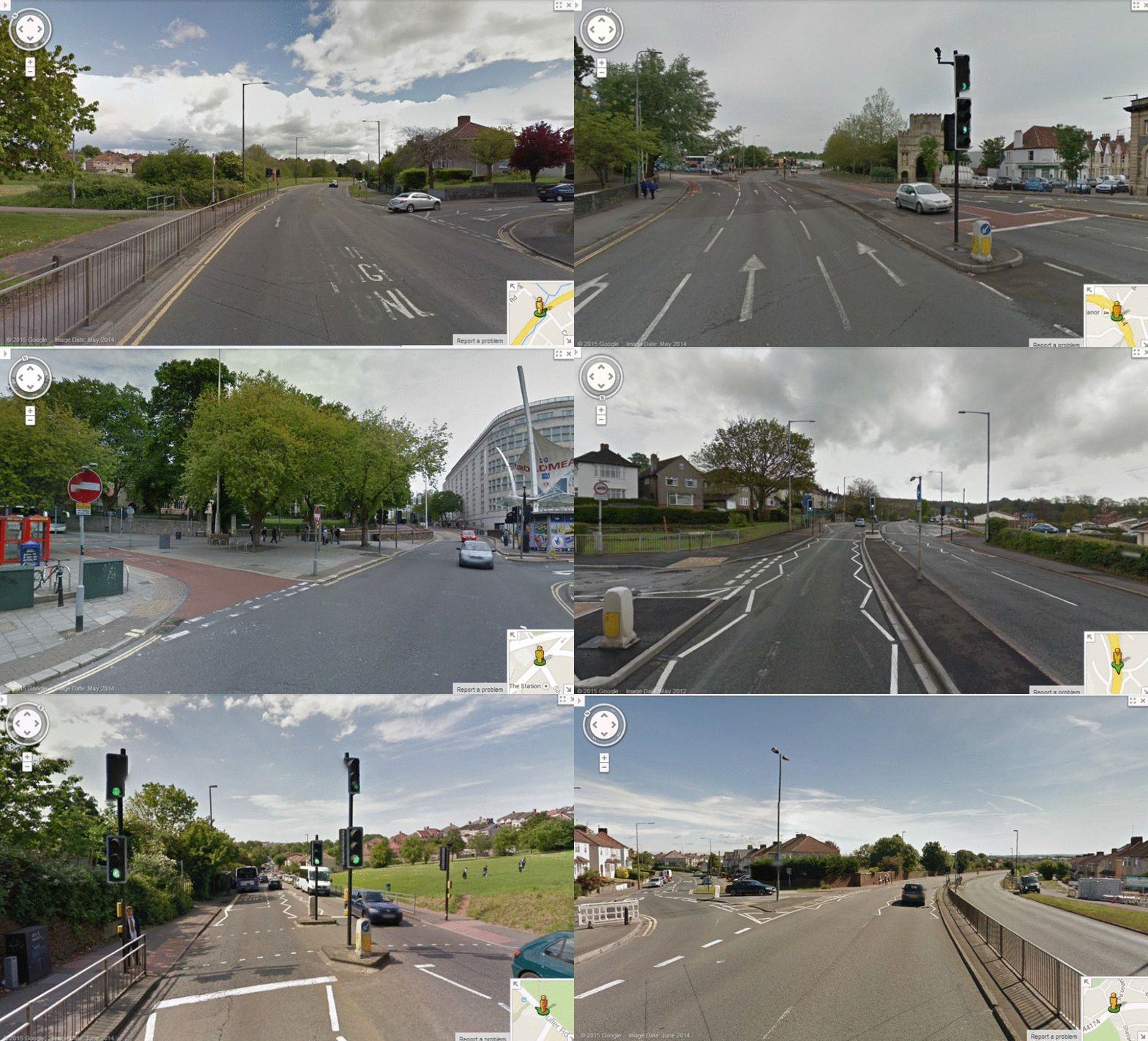
(i) Crossing points
Non-functioning crossing points
Images from Google StreetView
Images from Google StreetView
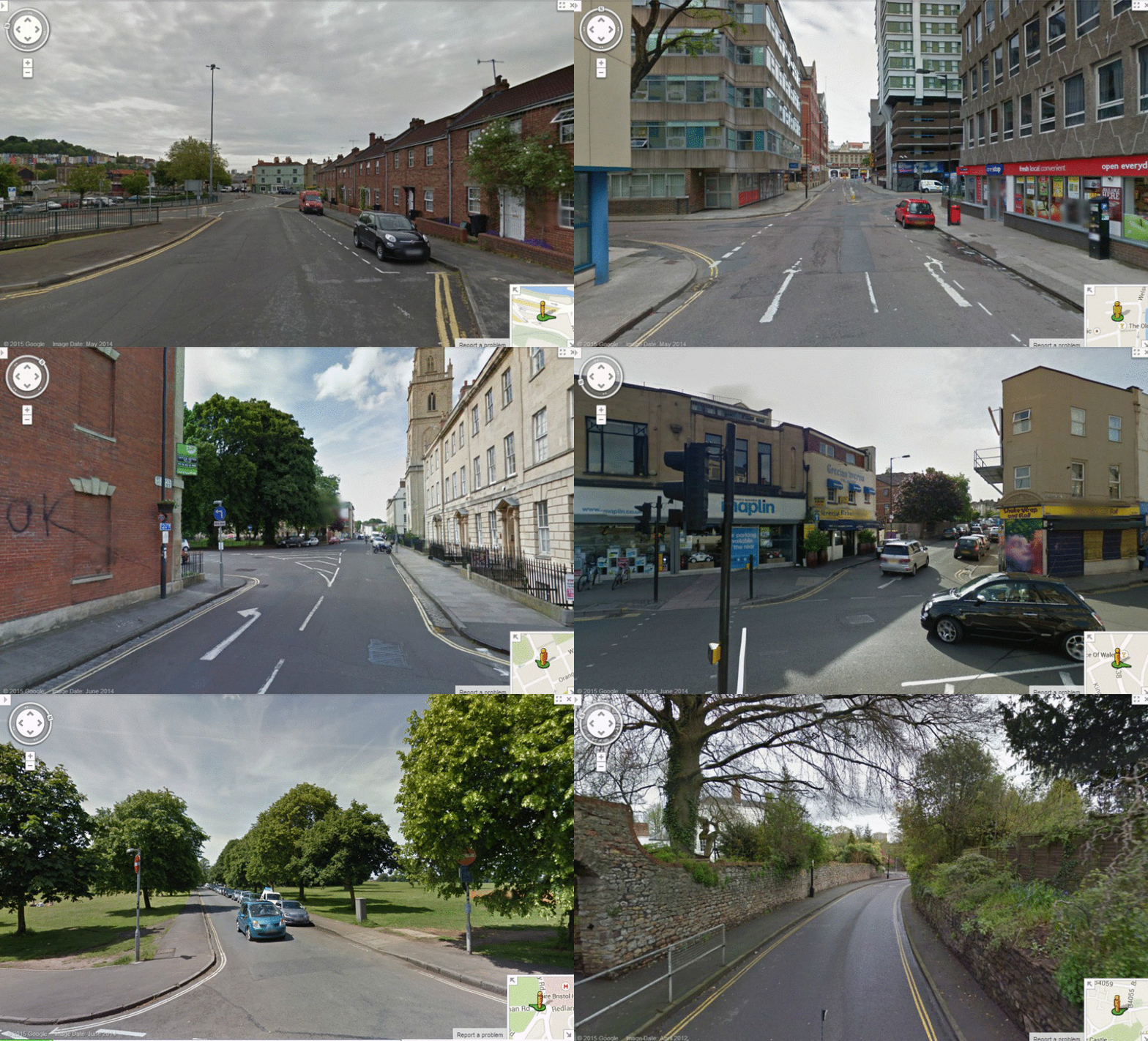
There are twelve crossing points which I have identified as non-functioning. In one case, maybe all that is needed is a gap installed in the central reservation. In most cases, it looks as though the crossing point can be shared with pedestrians (this arrangement would therefore need to be formalised). There are a few instances where something a little bit more innovative might be appropriate.
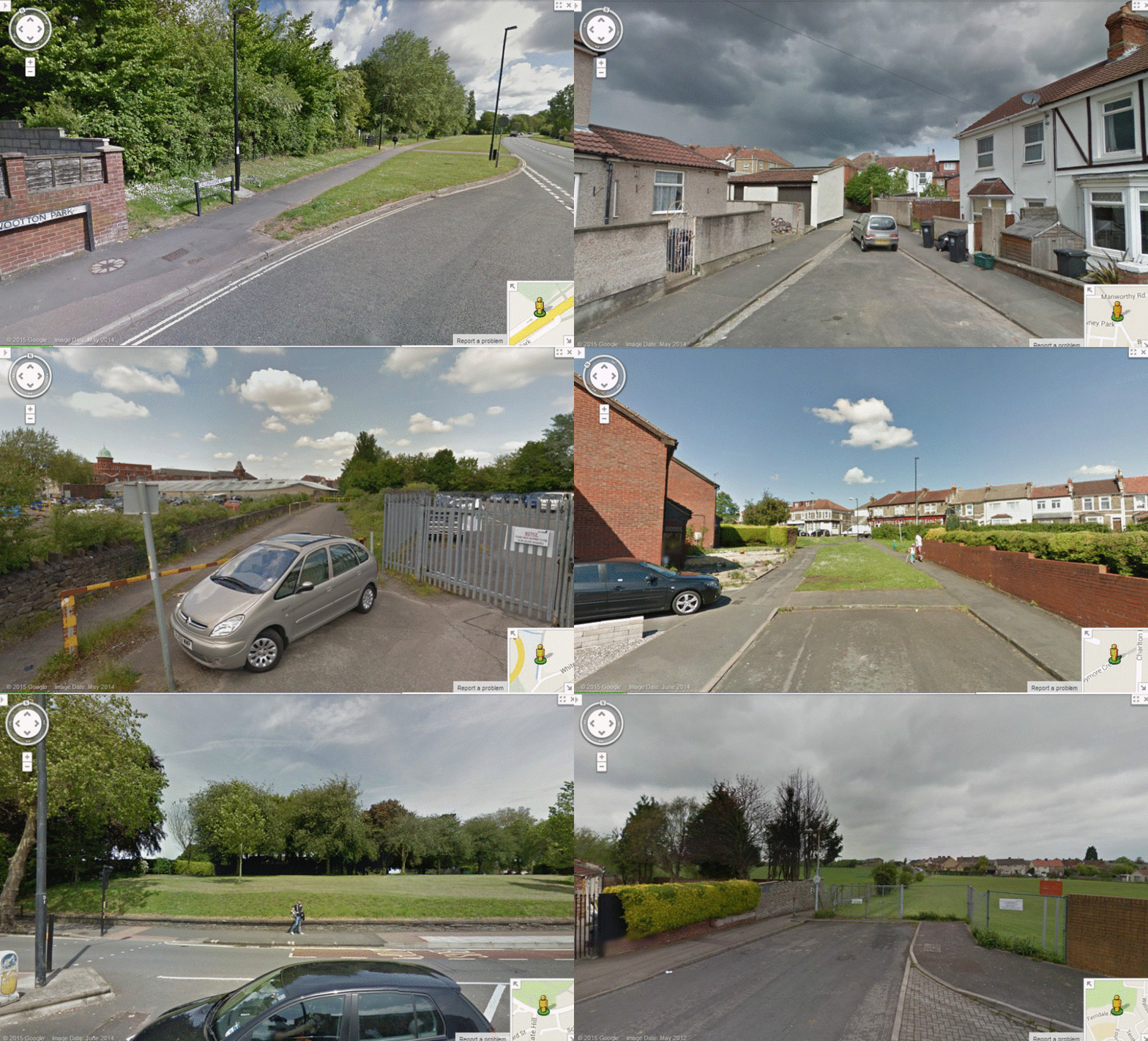
(ii) Missing links
Non-functioning links
Images from Google StreetView
Images from Google StreetView
In all, I have identified thirteen missing or non-functioning links. Crucially, it doesn't look like a lack of space is going to be much of a problem here.
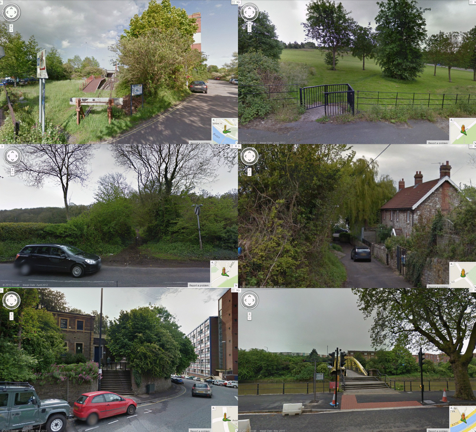
(iii) Path upgrades / steps
Path upgrades / steps
Images from Google StreetView
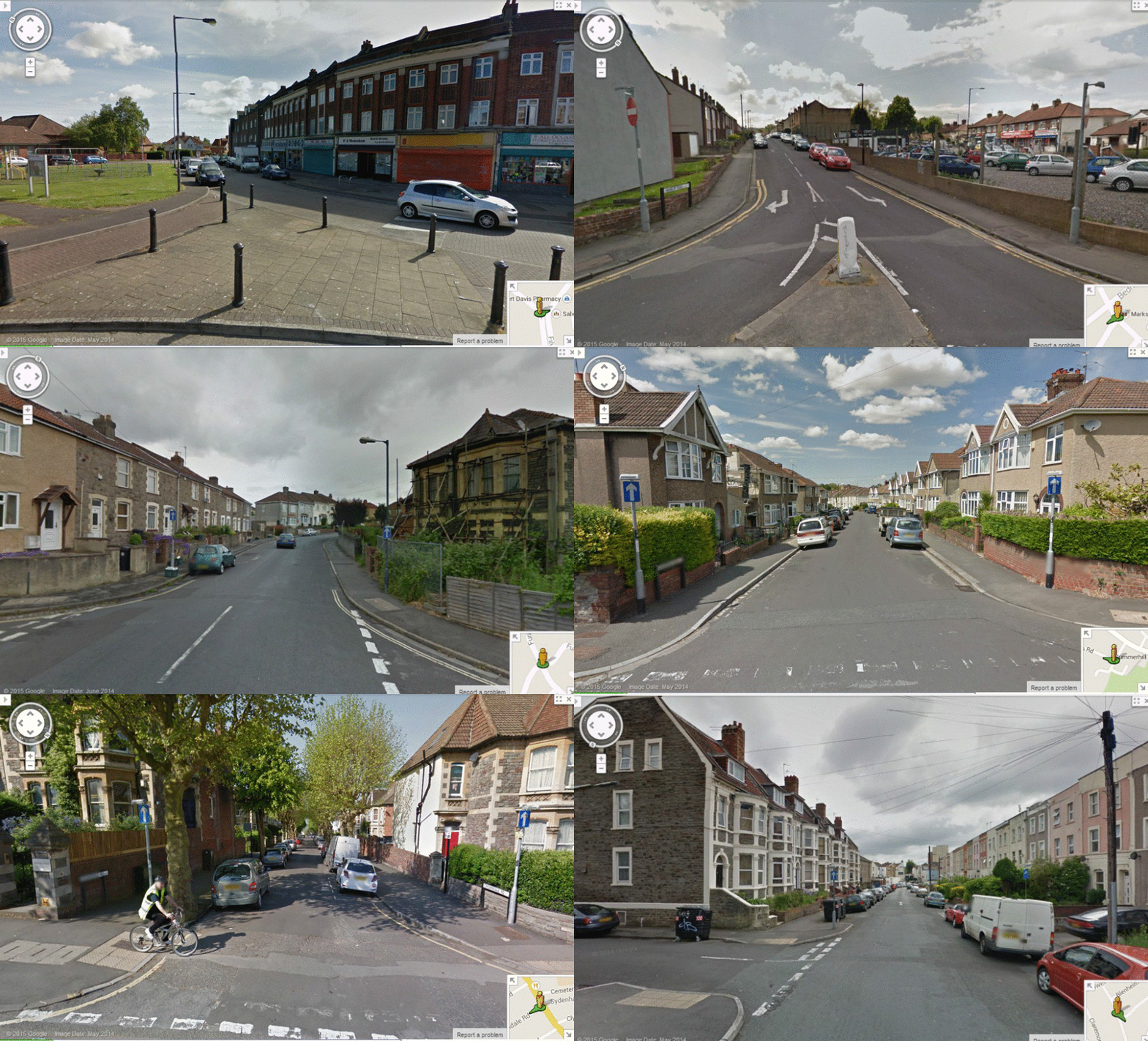
(iv) One-way streets
There are 25 one-way streets which are currently non-functioning and which have been incorporated into my proposed design for a strategic cycling network. Because I am limited in the number of photos that I can show in any one animation sequence, I have prepared two slideshows.
One-way streets - relatively less challenging
Images from Google StreetView
One-way streets - relatively more challenging
Images from Google StreetView
Conclusion
Bristol have committed themselves to the development of a cycle network which will make cycling trips more convenient and more direct. This is a laudable undertaking, but how to set about it?
Well, how many ways are there? In fact there are just two:
Adjustment policy. In the words of one blogger: "Isolated bits of infrastructure where they’re most needed (junctions, fast/busy roads), then join up the gaps, in order of neediness."
Holistic policy. In the words of another blogger: "Isolated bits and pieces don't work. The network is the infrastructure."
All of the evidence I have seen is in favour of the holistic policy. For example, Steffen Rasmussen told a GLA committee hearing: "The key word is an holistic approach, and then a separation of functions." (It was in fact the very first thing he said.)
The idea is to plan, study and introduce the network—get it up and running—and then develop it further "on the basis of priority interventions and a timetable." As before said, the key here is sustained investment.
The idea is to plan, study and introduce the network—get it up and running—and then develop it further "on the basis of priority interventions and a timetable." As before said, the key here is sustained investment.
 |
| Extract from the chapter entitled, How to start? Cycling: the way ahead for towns and cities |
The extended network I am proposing is intended to enhance the core network promoted by BCyC. It is clearly the case that most of the available funds would be spent on this core network. For not very much extra, however, several of Bristol's stated objectives would be met. Let's consider some of those:
"Our aim is to make cycling an easy and accessible choice for Bristol’s citizens. This means that the network must be clear and simple to understand for those getting around by bike, including mapping for journey planning and signing when travelling. The cycling network must also be direct and convenient to link citizens with key destination points such as the city centre, as well as connecting local communities."
"We will adopt a robust evidence-led approach, gathering intelligence to ensure top quality, value for money schemes are delivered."
"The proposed network is a long-term strategy to influence planning and investment decisions, and make best use of resources. The network will allow us to take advantage of opportunities, linking incremental investment into the bigger picture."
"We want innovation to be a key theme running through this strategy as we believe it is an essential ingredient to enable us to deliver our bold ambitions."
 |
| View larger map here |
Bristol Cycling Campaign were kind enough to say that the above map represents "some mightily impressive and clear work". That was about eighteen months ago. Unfortunately, they felt at the time that it went "far beyond" what they were able to work with. But I hope to have shown otherwise. I hope to have shown that it would not require that much more money and effort to develop an extended network. I hope as well that people agree with me that it would be worthy of further study.


