Thursday 25 April 2013

A study of Ipswich

In the Foreword to Cycling: the way ahead for towns and cities, Ritt Bjerregaard explains that, in order to create a healthier, urban environment, "the essential thing is to take that first step, because while the use of the bicycle is a choice for the individual, it is essential to launch the process by which your city builds on the initiatives and habits of some of your fellow citizens."

This process can be summed up as follows:

1. Think in terms of a network.

Only by studying a cycle route network will it be possible to truly grasp the situation. (p.40, Cycling: the way ahead)

2. Plan the network.

Analyse journeys — origin/destination. (p.56, Cycling: the way ahead)

3. Study the feasibility of the network.

Studying the feasibility of a network is of a similar importance to setting up a cycling unit or appointing a cycling coordinator. (p.57, Cycling: the way ahead)

4. Introduce the network.

The level of minimum functioning is a prudent course to follow. (p.56, Cycling: the way ahead)

5. Develop the network.

Develop the network further on the basis of priority interventions and a timetable. (p.56, Cycling: the way ahead)

* * *

The bicycle is indeed a choice for the individual, but as the Get Britain Cycling report makes plain: "Too many people in the UK feel they don't have a choice."

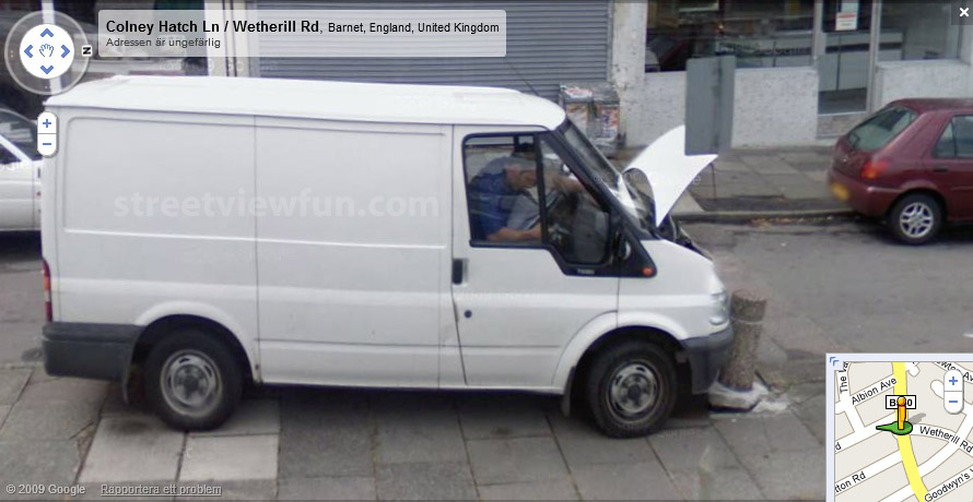
If, then, a town or city is going to build on the initiatives and habits of its existing cyclists, it would be helpful to have an idea of who these people are. As I explained in my last blog, Google Street View shows a long, connected 'snapshot' of the cityscape at a particular moment. Typically this will be during the day, not least because it is important that the sun is high enough in the sky to ensure that shadows do not obscure buildings.

In terms of gauging what road conditions are like during the morning and evening rush hours, therefore, Google Street View is of no use. This means of course that commuting cyclists are not represented in the imagery that we see. Even so, it is illuminating to identify what sort of people do actually ride bikes during the day.

I have captured pictures of every "cyclist" I could find along the course of one particular route, in one particular town.


The above-shown route has been provisionally coded as 'O2'

We're starting in the west, and heading across town ...

Bramford Road near junc. w/ Shafto Road

Bramford Road / Shafto Road

Bramford Road / Dandalan Close

Bramford Road / Windsor Road

Bramford Road / Yarmouth Road

Bramford Road / Gatacre Road

Bramford Road / Gatacre Road

Bramford Road / Prospect Road

Bramford Road / Bulwer Road

Norwich Road

St. Matthew's Street / Civic Drive

St. Matthew's Street / St. George's Street

St. Matthew's Street / St. George's Street

Crown Street

Crown Street

St. Margaret's Plain

St. Margaret's Green / St. Margaret's Street

St. Margaret's Street / St. Margaret's Green

Foxhall Road / Woodville Road

Foxhall Road near junc. w/ Camden Road

Foxhall Road / Dover Road

 Heath Lane / Foxhall Road

22 photographs in total, showing 20 people riding their bikes, and four people either standing with or walking with their bikes. Of the 24 people shown in the photos above, only one was adhering to Rule 59.

Of the 20 bike-riders, only four were female, and only one was a child under the age of ten. Of the 15 adult / adolescent males, three were riding on the pavement (including the elderly gentleman above). Instead of regarding these people as "heroes", however, the authorities are as likely to think these people should be punished with a fine.

* * *

I would like to take a moment to consider an extract from one of the five 'broad topic' recommendations contained within the Get Britain Cycling report:

Redesigning our roads, streets and communities

Too often cycle routes have been designed piecemeal or cyclists have been an afterthought in highway design. As we saw from some best practice areas, ‘thinking bike’ at the beginning of a design and planning process can reap dividends for other road users as well as cyclists.

Suitable road surfaces, arrangements at junctions, and interactions with other traffic are often about planning rather than cost. Cycle-friendly driving styles and the speed of passing vehicles can be supported by suitable design. Small improvements such as a well-placed bollard or junction redesign can make a big difference.

Purpose-designed exclusive rights of way, segregated from other traffic, are ideal, especially as part of a network of cycle paths and lanes, making use of verges, parallel rights of way, disused railways, bridal paths and similar. Continuity of funding would enable better and more cost effective planning of connected segregated routes.

Designated on-road lanes play an important role where segregation is not appropriate, and may require reallocation of road space. They need to be substantial - too often in the past they have been token gestures, ending abruptly at junctions, weaving across pavements, or just too narrow.

* * *

In a sentence, "The objective of good design is to create a safe and comfortable cycling experience for the entire end-to-end journey."

The question, surely, is how do we realise this objective?

If we take a moment to think about it, it is quickly apparent that there is only one practical way to set about the development of a safe and comfortable experience for the entire end-to-end journey, and that is to pursue a global or holistic approach. We can't keep doing things piecemeal. That doesn't work. Cycling needs connectivity and it needs density, and this can only be provided for during the planning phase. (A safe and comfortable cycling experience, by contrast, can only be provided for during the development phase, so let there be no debate about what comes first.)

In addition, as I report in this blog, "Mobility is not just about getting from A to B, but also about knowing how to get from A to B." Cyclists therefore need to be aware of, and to be able to make use of, an information set for optimising their journey.

In Holland, direction signs at strategic locations (such as at junctions) enable people to find their way without having to refer to a map. The video below, produced by Mark Wagenbuur of Bicycle Dutch, explains how these signs work in the city of 's-Hertogenbosch.


In the UK, where the provision of quality infrastructure for cyclists is incomplete, there's a tendency to publish maps which show what conditions are like on the ground, so that if you did want a traffic-free route, you had the opportunity to plan one.

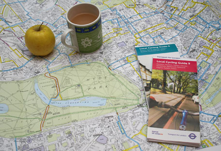
Image from rashbre central

These sorts of maps ignore several truths, however. The first is that more than a third of the population can't actually read a map. Indeed, in 2007 a thousand drivers took part in a survey commissioned by an insurance firm, and it turned out that fewer than one per cent of the participants knew enough to earn a Cub Scout map-reader's badge. The second is that, even if you can read a map, it is simply not practical for most people to do this in a safe way whilst cycling (i.e. whilst moving). So this means you need to stop, get your map out, work out where you are, and then work out what you need to go next. The third is that it is almost certainly impossible to travel any sort of distance in UK towns and cities without encountering motor traffic. The idea of a map which shows some traffic-free routes, here and there, is a little bit of a distraction, therefore. This brings us on to our final point, which is that, if the road conditions are regarded as too dangerous, people in general, and children in particular, are going to ride on the pavement regardless of whether or not there is any legitimised provision for cycling thereon.

* * *

The photos below are all of the same road: Friars Stile Road in Richmond.


This section of road is coded in blue in the London Cycle Guides.

This section of road is coded in yellow in the London Cycle Guides.

This section of road is not coded at all in the London Cycle Guides.

That's three photos of the same road, each of which is marked differently on the map.

* * *

Another way to code routes in the built-up area is to assign one colour per route. The main problem with doing it this way is that there are only so many individual colours to choose from. If you have a network of fifteen-plus routes, one colour per route is pretty much a non-starter.

It is an established fact that colour-coded routes make journey-planning easier, and this is why I believe that compass colours represent a real breakthrough in terms of pursuing a 'network first' approach. In those towns and cities which have a certain density and a certain shape, I am confident that I would be able to code most networks. I would like to show you how I set about doing this in the case of Ipswich.

Ipswich and surrounding area

As you can see, Ipswich is bordered on three sides by major roads. The town itself has a wagon-wheel shape, which I like, although the rather large river which runs up from the south gives it the appearance of a cake with a slice taken out.

The first thing I did was to transfer all the route information shown in the Ipswich Cycle Route map [pdf] onto Google maps. I coded all the routes in the same colour because it didn't make any difference to me what the conditions were like on the ground - I just wanted to know where the officially-approved cycle routes went. I made a mental note of those routes on which you are supposed to walk your bike.

If you are interested to see what it looked like, please click here.

The next thing I did was to lay some compass colours over the top. It sure didn't look pretty, but it gave me a starting point. You can see the first draft by clicking here.

Then I started laying down the routes on a clean map, and just kept reworking it so that more and more of the officially-approved routes were included, and more and more of the routes were presented in such a way as to show self-consistency.


Red-coloured routes


Navy blue-coloured routes


Red and navy blue-coloured routes. These 'bold' colours give the map its basic identity.


Green-coloured routes


Orange-coloured routes


Cyan-coloured routes


Circular route


Finally, once I was reasonably happy with the way the routes had been laid down, I copied them onto the original template, as can be seen here. This gave me the opportunity to see what was missing.

You can probably see that a green-coloured route could be installed going from Brazier's Wood (near the Orwell Bridge) up to Kesgrave. If the authorities liked the look of this they would do well to take note of this advice from Cycling: the way ahead: "All the installation measures which call for little planning may be applied without major risk of error or loss [...] Given their low cost, the small amount of extra work which they entail and the possibilities of corrections in the case of error, such measures may be adopted automatically."

Warren Buffett says, "I don't look to jump over 7-foot bars. I look around for 1-foot bars that I can step over." The case is, as Cycling: the way ahead explains, "The network can be introduced on the basis of an overall plan (preliminary plan)." In the first year or so, we simply do not need to make it any more complicated than that.


View Ipswich Cycling Network (proposed) in a larger map

[Update: There were some routes missing. You can see on the map above that I have replaced the route C122 - Cyan1 to Cyan2 - with a dark green-coloured route. Whether this has made it better or worse is not for me to say. But do please bear in mind that the map you are looking at could easily fit onto the back of a post-card.]

* * *

Mark Ames over at i b i k e l o n d o n recently concluded one of his blogs by leaving the last word to cycling's ambassador of common sense, Chris Boardman. If you want to read the quote in full, please click here. "The key is local governments having a clear and detailed holistic view of what they want their cities to look like in 10 years."


Sunday 21 April 2013

A virtual study of Coldhams Lane, Cambridge


In the good old days, before Google, I used to make large sheet maps of London by photocopying pretty much the entire contents of an A-Z, at various zoom levels, and then cutting and pasting the photocopy pages together. Because this involved a lot of fiddling about, I would keep this "master copy" separate, unblemished by lines of coloured ink. Rather, I would photocopy A3 pages of this, ten at a time usually, paste these together as I needed them, and then draw my lines all over these second generation copies.

Making a mistake was, on the whole, excruciating, though sometimes, as with any evolutionary process, a copying mistake actually resulted in something better than before.

Since Google have done their thing with the maps, however, those days are long gone. Indeed, thanks to Satellite and Street View imagery, I don't even need to get up from my chair to see what the conditions are like on the ground. This means that I am able to code the routes for cycle networks in places that I have never even been to before!

I tend to refer to the Street View imagery quite a lot, and during the course of this research, it has of course occurred to me that what I am seeing is a series of snapshots that capture events during the course of a typical day.


Image from streetviewfun.com

There are a couple of disadvantages with using Street View. The first is that you cannot venture too far away from the road. True, you can get some idea what is going on from the satellite imagery, but even so, you still need a bit of imagination to fill in the gaps.

The second problem is that the imagery we see is not necessarily the result of a single day's shooting. In the built-up area the Street View cameras capture a set of images in one direction, and then another set of images on the return journey. Because Google don't want any gaps in the Street View imagery, these pictures are then "stitched together" to create a "seamless" image. However, you have only to look at the weather to realise that some of these pictures must have been taken at different times (see at 1' 03" in the video below, for example).

A small independent team at Teehan+Lax have developed a user interface
for creating interactive Google Street View hyper-lapse animations

Any road up, the point is that the Street View imagery fairly reflects what we might expect to see on a normal working day. And it's not selective. It doesn't look over its shoulder, see a cyclist coming its way, and think to itself, "Right, I'll just wait for this cyclist to pass in front of me so that he (or she) appears in my shot." It just tells it as it is.

Of course this may mean that we might not necessarily like what we see, as this comment posted on a website for British expats serves to demonstrate:

Hi, I have been looking on Google maps as part of my research for where I'm going to move to, but when I use the Street View it appears that life doesn't exist!

I'm looking at various streets in Cairns (Queensland), which I know is small anyway, but surely there must be more life than what is shown. The roads seem empty and the people are non-existent. It's like a ghost town - or is that what Cairns is really like?

Hmm. Please reassure me that I'm not moving to a town of 10 people with one car between them.

About a month ago, I finalised a proposed design for a City of Cambridge Cycling Network. Most of what I know about cycling in Cambridge is gleaned from what I have been able to pick up from Street View and from what I have read in the blogs. I have seen that one blogger talks about cycling in Cambridge as being "very much a gown-versus-town thing", and whilst I am not at all in a position to controvert this, I have also seen that another blogger insists that, whilst Cambridge is still two different cities, "it's not 'town' and 'gown' anymore".

Whatever the truth, I decided to take a virtual journey on a route which is very much on the 'town' side of the City. I am talking about Coldhams Lane, beginning north of the river and heading south.


I am going to follow the blue route ... please come along.


Our journey begins!

On the south side now.

Looking back towards the bridge.

We're going to turn left here, up River Lane.

Looking up the hill.

Looking down the hill.

Back on the flat.

A cyclist turns right up ahead.

River Lane junction with Newmarket Road.

Newmarket Road. Coldhams Lane is to the left, River Lane to the right.

Coldhams Lane junction with Newmarket Road (looking east).

Coldhams Lane junction with Newmarket Road (looking west).

Looking up towards the junction with Newmarket Road.

Looking back down Coldhams Lane.

New Street at the junction with Coldhams Lane

Coldhams Lane at the junction with New Street. 

As one woman cyclist sails past the entrance to Henley Way, another
woman cyclist cautiously crosses, accompanied by a young girl.

An elderly couple go to cross Silverwood Close. Note that up ahead
the carriageway is considerably wider.

Looking back towards the junction with Henley Way.

Approaching the junction with Henley Road / the Beehive Centre.

The junction of Coldhams Lane and the Beehive Centre, as viewed
from the entrance to Henley Road.

Henley Road.

The junction of Coldhams Lane and Henley Road, as viewed
from the entrance to the Beehive Centre.

As above, except a little further back.

Looking towards the Beehive Centre. The shared-use path is to
the right.

Back to the junction of Coldhams Lane and Henley Road. The woman
who is using the shared-use path has a trailer in tow.

Coldhams Lane (looking south)

Approaching the bridge over the railway line. To the right, a separate facility
has been specifically constructed for use by pedestrians and cyclists. For
southbound cyclists, access to this facility is via the toucan crossing.

A father and his young daughter amble along.

As we will see, the problem for southbound cyclists is not so much getting
onto the shared-use path as getting off it.

Instinctively, these "badly-behaved" cyclists want to keep out of the
motorists' way. In my opinion, this does not make them lawbreakers.

On the bridge.

Continuing south.

Approaching the junction with Cromwell Road.

There are two cyclists in this shot. Both have come from Cromwell Road.
One has turned right and is heading away from us, the other has turned
left and is heading towards us. Whether by accident or not, the left-turning
cyclist has gone past the entrance for the shared-use path.

[Looking back] Perhaps the cyclist in the last shot has disappeared
into the industrial estate on the right.

This pedestrian has evidently just come from there.

The shared-use path comes to an end. In order to continue their journey,
southbound cyclists just need to cross back over the road.

No problem.

No really, it's no problem at all.

It is intended that a new bridge across the River Cam will be built one
day, and from here the most direct route would be to turn right.

[Looking north] Note the sign on the left, and recall that there was no such
similar instruction at the other end. I might also add that a few repeat
markers laid down on the road would serve as a less obtrusive and no
less effective "interim" measure.

The road is busy with traffic.

[Looking north] Two children carelessly chat to one another.

[Looking north] These two cyclists, a schoolboy and a woman, prepare to
squeeze past each other. Although illegal, one could argue that
this is still 'better' than a huge great lorry - like the one coming towards
us - squeezing past a cyclist.

[Looking north] Coldhams Lane at the junction with Ross Street.

Pootling along.

Another pootler.

[Looking north] At the junction of Vinery Road.

Approaching the junction with Barnwell Road.

A quick look back.

The shared-use path heads off to the left ...

Approaching the roundabout from the other direction.

Analysis

Of the cyclists

In the photos above, we saw four people pushing their bikes - one of whom was a young girl - and 34 people riding their bikes, 21 on Coldhams Lane. (The resolution in these photos is not as high as in the original Street View imagery, so you'll just have to take my word for it.) Of the 21 on Coldhams Lane, one was a child under ten, and three were children under sixteen: all four were riding their bikes on the pavement and not one of them was wearing a helmet.

Of the 17 adults on Coldhams Lane, nine were male and eight were female. Only one of the adult cyclists was wearing a helmet, and not one of them was wearing hi-viz. In fact, the most popular colour by some considerable margin was black.

Six of the adults were riding their bikes on the pavement, only one of them legally (she was on a shared-use path). Of the five "illegal" cyclists, one was accompanied by a child and two were crossing the bridge over the railway.

Only one of the adults on Coldhams Lane was what you might call a "cyclist" (as opposed to a "bicyclist"). Possibly this might be explained by the time of day, but what these people lack in terms of a visible presence on roads like this one, they more than make up for in terms of an audible presence at council meetings.

Of the road

Coldhams Lane can be separated into three distinct parts:

(i) Between the junction with Newmarket Road and the junction with the Beehive Centre / Henley Road


There are three side streets (two of them cul-de-sacs) between these two junctions, each of which has its own filter lane for right-turning traffic. 

learners-guide.co.uk says that for right turns, "when the road is wide enough you will often have filter lanes to use, which help to keep traffic flowing by allowing traffic to pass on the left."

In the new vision of town planning, ensuring that the traffic is kept flowing on roads like Coldhams Lane would no longer be regarded as a high priority. 

(ii) Over the railway bridge

The value of the only purpose-built infrastructure on Coldhams Lane to benefit cyclists is somewhat diminished by the fact that it is not very easily on-and-offable, particularly for southbound cyclists.

(iii) Between the junction with Cromwell Road and the junction with Barnwell Road

An advisory cycle lane is in place for the pretty much the entire length of this stretch of road.